
GPS navigation systems really hit the mainstream in the early 2000s. Another decade later, and they were included on just about every vehicle in the market. What you might not know is that GM had in-vehicle GPS navigation up and running as early as 1991.
Of course, GM wasn’t the only company fiddling about with navigation at this time. The idea of turn-by-turn route guidance had long existed in the industry, and it was only in the early 1990s that technology got to the point where it was even plausible. When that happened, GM was right there, ready to invest in a cutting-edge project to make it happen.
And yet, despite this early start, it would be quite some time before navigation became commonplace across the company’s fleet. Let’s explore why.

Future Forward
Known as TravTek, GM’s system basically previewed the navigation systems we use today. Unlike some early navigation systems, this wasn’t some weird electromechanical system, nor did it rely on expensive localized infrastructure. Relying on GPS for guidance, it was a fully-featured system, even integrating real-time traffic feedback and a points-of-interest database.
The system was built by a grand partnership. GM teamed up with AAA and the Flordia Department of Transportation, initially equipping the system for a trial in the city of Orlando. This was an ideal test case for the system, as it would have great utility in helping visitors navigate the popular tourist destination.


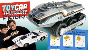
The system was based on the existing Visual Information Center (VIC) display as used in the Oldsmobile Toronado and Trofeo.To that end, GM built 100 test vehicles equipped with TravTek, and it gave 75 of them to Avis to use as rental cars. The other 25 were given to local test drivers. If you were visiting Orlando in 1992, for example, you could rent yourself a duly equipped Toronado for as low as $29 a day, or just $139 a week.
GM chose the Oldsmobile Toronado as the testbed for the TravTek system. It made perfect sense, as the TravTek system was developed from GM’s earlier Visual Information Center (VIC) display used in the Toronado. Pressing the “NAVIG” button on a VIC only gave you a compass. On the TravTek cars, it gave you access to a fully-fledged touchscreen GPS navigation system.


The TravTek VIC unit was mounted in the center of the dash just like modern infotainment units. It used a color cathode ray tube, providing a crisp and bright image that wasn’t possible with contemporary LCD technology. It displayed simple line maps to provide turn-by-turn guidance to the driver’s chosen destination. Voice instructions were also provided courtesy of a crude speech synth. Based on the sound output, it sounds curiously like the Texas Instruments TMS5100, though a number of speech synths in that era had a similarly robotic sound due to technical limitations.
The system could navigate to points of interest selected from its own rich database. Alternatively,you could choose a street or intersection from the list as your desired destination instead. Thus, it was useful both for tourists visiting major attractions, as well as locals just wanting to get around the city.


Much like modern systems, TravTek could also customize a route to your tastes. Namely, it would let you choose to avoid toll roads or interestates if you so desired. Otherwise, it would just find you the fastest route to your destination.
GPS satellites were only just over a decade old, but they provided the necessary navigational signals for the TravTek system to determine the vehicle’s position. A large and unsightly antenna sat on top of the rear of the car to pick up the satellite signals reliably. Also helping out in this regard was a built-in digital compass, along with wheel sensors that measured the vehicle’s speed to aid in location tracking. This was particularly helpful, as at the time, civilian GPS signals were limited to a far lower level of accuracy than today. Years later, this would eventually change when President Clinton decreed the end of Selective Availablity for GPS, which drastically improved the accuracy of civilian GPS systems.


The system was actually more fully featured than many GPS units that hit the market a decade or more later. Through the assistance of the Fedaral Highway Administration and the Florida Department of Transport, the city of Orlando was granted a new Traffic Management Center. Through a network of distributed cameras and sensors, the TMC tracked traffic conditions across the city. Traffic data from the TMC was sent to TravTek units over an FM radio link, advising drivers of congestion on their routes.
Based on TMC data, the display would also show red stars denoting accidents, red circles for closed roads, and yellow circles to denote heavy traffic. TravTek was capable of rerouting in cases of severe congestion or other hazards with the touch of a button. The connection was two-way, with TravTek able to notify the TMC of its own position.

For AAA’s part, it established the TravTek Information and Services Center to support users of the system over the phone. This is demonstrated in a TV segment from Beyond 2000, an Australian technology show. The presenter makes a wrong turn (obviously on purpose), and then hits the system’s Help button. This triggered the rental car’s phone to dial in to AAA’s help center. At the center, an assistant advises the presenter on what to do. Automatic rerouting wasn’t a thing on TravTek, but it could determine if you got off route. In that case, it would ask if you wanted it to generate a new route to your destination by pressing a button.
AAA also provided a rich source of local information for the TravTek system. Baked into the database was a list of hotels, tourist attractions, and other points of interest that could readily be called up on the TravTek display. Users could see a hotel’s AAA rating and even learn if it had a swimming pool if they so desired, all on the screen. At the touch of a button, they could then place a call to the hotel if they wished to make a booking. Or, they could simply use the navigation instructions to get there and make their inquiry at the front desk.


Going beyond that, AAA even provided TravTek with a list of “Things to See and Do.” This advised the user on upcoming concerts, plays, and performances, even including details as granular as show times and ticket prices.
Building the system specifically for use in Orlando helped control the scope of the trial. This meant that infrastructure to support TravTek only had to be deployed in one city, and this limited staffing requirements in turn. Storing map data and points of interest was also easier when the system only had to cover one city. Storage and RAM were both incredibly expensive in this era, after all, to say nothing of the effort required to produce the digital maps and data in the first place.


The Beyond 2000 segment gets a little creepy. “Hello Joe, it’s Tracy,” she says, as she drives with her eyes closed.

Well Received
The retro system might look old and complicated, but it was remarkably well received during the trial. Data was collected from over 4,000 volunteer drivers who used the system over the 12-month trial period, most of which provided positive feedback on the technology.
A questionnaire was given to determine driver perceptions of the system. A value of 6 was assigned to “Strongly Agree,” with 1 assigned to “Strongly Disagree.” Drivers resoundingly stated that the TravTek Guidance Display helped them find their way (5.7), and many found the voice instructions similarly helpful (5.4).
Overall, 96% of drivers surveyed believed TravTek would be useful for “out-of-town business driving,” while 99% believed it would be useful on vacation. Interestingly, though, just 39% believed it would be useful for driving “at home.”


Research into the device also found that TravTek slashed trip planning time for drivers. Setting up the system at the start of the trip took just 30 seconds, relative to 5-8 minutes for drivers that used traditional paper maps. Travel times were shorter too, which was perhaps a function of drivers making less mistakes.
In direct testing, researchers also found that every driver using the system found their destination. In contrast, 7 percent of drivers in the control group failed to reach their intended destination. It also appeared that the system helped reduce the workload on drivers navigating to unfamiliar destinations, though this was based on some subjective assessment by researchers.
Ultimately, 47.9% of drivers stated they liked TravTrek a whole bunch. Amusingly, though, one feature stood out as unpopular. 31.2% of drivers stated the synthetic voice was their least favorite feature. Much of this came down to the poor intelligibility of the voice. Few actually wanted it eliminated entirely.

Future, Faltered
The system worked, and the drivers liked it. So, TravTek ended up as a market success, right? Well, not quite.
One problem was cost. In 1992, a handheld GPS receiver cost over $1,000. That was with a tiny black-and-white LCD display, no maps, no guidance, or any advanced features whatsoever. In contrast, the TravTek system would have been far more expensive to implement. It had a large color display, the ability to display directions, read out voice commands, and store a great deal of map data. All that data also cost money to collect and maintain. Plus, there was the added cost of support staff and infrastructure like the Traffic Management Center and AAA’s hotline for user assistance.

Cut back to the research, and it was clear that the business case wasn’t quite there yet. Researchers found that customers were willing to pay around $1000 to $1200 for a TravTek system, either as an aftermarket accessory or as an option on a new car.
At those prices, it would be difficult to cover the cost of the hardware required in the car. That’s saying nothing of the staffing and infrastructure costs to keep the whole system running, either.
Scale would also have been a challenge. Rolling out the system across the country would require ramping up staff on the back end to create and maintain maps and point-of-interest data for every city in the nation. There would also be the question of whether it would be cost-effective to have a TravTek unit store data for the whole country. With storage in the 1990s being incredibly expensive, it may have limited an individual car to storing maps for its local area only. This would have limited the system’s effectiveness for longer-range roadtrips —ironically where it would be most useful.
Ultimately, the system was just too expensive to work as a mass-market offering at the time. TravTek wouldn’t go beyond its initial 100-car trial. The Oldsmobile Toronado and its pioneering VIC system wouldn’t last much longer either, with the car cancelled after the 1992 model year.

GM didn’t give up on its ambitions for a navigation system. It would return in 1995 with the GuideStar system, while multiple European and Japanese automakers were all rushing to market with their own systems. Even years later, the GuideStar system could still only cover 17 states. It was a $2,000 option on the Oldsmobile Eighty-Eight for that model year.
Ultimately, it would take another decade or so for GPS navigation to really find its feet. In the early 2000s, lower cost electronics helped GPS units make real market penetration, as did the improvement in GPS accuracy enabled by the Clinton administration. And yet, GM really did have it all figured out all the way back in 1992. As long as you were happy just driving around Orlando, that is.
Image credits: GM, MotoringTV via YouTube screenshot, R D via YouTube screenshot, US DOT, Federal Highway Administration


The Eunos (Mazda) Cosmo had a touchscreen GPS in 1990. Not in the US, though. But it was in the production vehicle, not a small-scale test, like this. And with a much better integrated GPS antenna.
Every time I read about some interesting optional feature, I wonder about who bought it. I dream of being the person that buys the fully-loaded new car and drives it for 30+ years. Then I remember I am poor and poors don’t get new cars. Especially not with optional features.
When you think of the limited computing horsepower available in 1991 this is truly a remarkable achievement.
Right? I’d love to know what kind of hard drives they were rocking in this baby, too.
Gotta love that old 90’s computer voice. 🙂
I know it’s de riguer to attack GM for abandoning good tech, but in this case it was an experiment that was truly, wildly, astronomically unfeasible to implement commercially. That $1k cost mentioned in the article for the receiver should be doubled for modern currency – so, figure $2k – and in 1991, a computer capable of handling the data and display requirements would have been the equivalent of $6k plus in desktop form. So you’re talking about a $10k adder for the packaged hardware in an optimistic scenario, and that’s without accounting for the back-end costs as the article correctly points out.
Also, storing a single city locally was expensive; storing the country was just out of the question, even if you had the data – which they didn’t. In the late ’90s – years later; eons in tech-years at the time – you could add up the required hardware to have a laptop with a GPS receiver and major-city GPS routing functionality, and it was still tens of thousands of dollars. And that was with CDs a thing, and RAM at 1/100th the price, etc.
It’s also worth noting that from our perspective now, it’s easy to look back and say, “Oh, they had this super early” – but even if all the cost issues had been sorted, people didn’t want it. The people who tried it liked it, but those aren’t the people GM needed to sell it to – they needed to sell it to people who’d never used it, and who had always used paper maps. I’m old enough to remember it being like pulling teeth to get people to countenance printing out routes from MapQuest, let alone using a GPS. New-fangled, useless computer garbage – it’s just more stuff to break!
GM made the right call shelving this.
“Printing out routes from MapQuest” I forgot that interim step in GPS development, you had the tech at home or work, but not in your car, so you printed out the route. Those were the days.
Username checks out.
I had an early Hertz NeverLost in 1996 or so during a business trip to Orlando and it was just magic. I had taken a couple extra days to see spring training games, and it got me to the podunk ballfields with no problem. Then when I still had daylight to burn, I scrolled through the points of interest and found that Kennedy Space Center was only a couple hours away! Awesome! Take me there!
It was ugly and slow and took a huge CD changer in the trunk, but there was no doubt it was the future.
“Current destination – Chi-Chis. Do you wish to be routed to this destinatio” Yup!
After I’m done at Chi-Chi’s, I’ll need directions to the Ramada Inn.
The most Coastal suburban Florida of nights out, took the wife out to chi-chi’s bar and grille in the olds and took larry’s wife to the ramada inn when the bowl was passed around
It may just be a composite car drawing used for the Overview of the TravTek system page from the guidebook, but man, that car looks suspiciously like an 87-93 Chrysler LeBaron coupe body. Did GM outsource the guidebook to an outside supplier and they just went, “it’s a car, who is gonna notice”
That’s definitely a Dodge Shadow / Plymouth Sundance. Right down to the belt line and the slope of the hood. Even the somewhat IROC Z looking wheels are from Chrysler.
Nice validation! It’s definitely the 2door P Body vs the Le baron coupe
Can we give a shout out to them running a proper scientific study of it’s usefulness? Amazing tech for the day.
And all this for an investment of just $12 million.
This story is certainly on brand for GM: develop incredible tech then abandon it out of fear of not making money.
Well, it was a well founded fear when you figure how much it cost them to run the tech for just one city. The cost of a nationwide version of this GPS system, even slightly watered down to just use addresses and not have things like hotels and restaurants stored, would’ve been astronomical. Even ten years later, a system not much more advanced than this was still an expensive luxury.
When it became cheaper (and when the govt opened up the GPS spectrum of radio waves more importantly, in the early 2000s) GM sat on their hands and let Garmin and lux car brands jump on it. Same with EVs.. I’m sure the list goes on.
So did GM ultimately crush them or are there some holy grail Toronados still out in the wild? I always thought these cars looked great and they aged quite well.
I was going to post if I was the only one with a sudden urge to see what kind of last gen Toronados are for sale. Forgot how neat the first ones were too, with the “slot machine” speedo.
Being rental cars, the odds of survival this many years later would be low to begin with, even without experimental electronics
The AAA connection is really interesting to me, because just as GM couldn’t use its opportunity back then for all kinds of reasons of corporate inertia, neither could AAA.
In the 1990s, nobody had the amount of up-to-date data on roads and amenities like restaurants, hotels, and attractions that AAA had. If you were planning a road trip from Miami to Seattle, nothing was a better source of information for planning your trio than AAA. If you were planning your day-four itinerary between Louisville and St. Louis with a side trip to Carbondale, AAA could give you six different options for where to stop for lunch and a fun tiadside attraction to visit.
I worked for a company in the late 90s which pitched linking into their data online, and we would have paid through the nose for the opportunity. And I have no doubt far richer companies like Expedia or Travelocity would have paid even more. Nobody, not even Frommers or Fodors, had as much breadth and depth as AAA.
AAA’s attitude was nope, we’re good. Our priority is keeping this info exclusive to our subscribers. So what happened is AAA lost an opportunity to monopolize a data source that could have been worth tens of billions of dollars over time.
To be fair, the online gold rush of the late 90s ended up being a mine field. If AAA had screwed up, they might have ended up like pets.com. They might have had an IPO and bought a skyscraper in Manhattan in 1999, then gone bankrupt by the end of 2000. But they had a unique high quality source of nationwide data unrivalled in the country, and with halfway decent leadership they could have made a mint.
Motorola had a similar system under test in the early 1990’s in Chicagoland. It was developed partially as a means of improving road network efficiency by testing the ability to route cars based on traffic demand. Of course, the other part was to test the economic viability of a real time routing system. Data was moved from traffic sensors into a real time macro simulation of Chicagoland arterials – something that the MPO was already doing. Then cars could theoretically be routed for better drive time and reduced emissions. It fell apart after a few years when funding dropped off and it just wasn’t priced for the market yet.
Nice insight! Any docs out there on it?
Ahh, looks like I tossed those binders making room for more junk cars. Best I can find is a patent for the in car congestion system and ancillaries – https://www.freepatentsonline.com/5164904.html
Anybody else remember this one?
And the Motorola equipment patents – https://www.freepatentsonline.com/6216086.html