


America’s highways are marvels of engineering. There are roads to take you just about anywhere in this country, and these surfaces support everything from motorcycles to leviathan trucks up mountains, through cities, and even in tunnels underwater. But one highway stands out as especially ambitious, and it’s Florida’s iconic Overseas Highway. This 113-mile highway and its 42 bridges aren’t just a road, but it’s a lifeline connecting the Florida Keys to the rest of America, and building it was a monumental effort.
I’ve had a list of dream road trips ever since I was a kid. Back then, I learned there was a highway that wrapped around the cliffs of the California coast and another, even more famous highway that stretched from Chicago to California. Then there’s a highway in Nevada that goes on for hundreds of miles through apparent nothingness, salt flats you can race your car on, and a bridge that runs an incredible 23 miles across a lake in Louisiana.


One of the blessings of being an automotive writer is that I’ve been able to make many of these dreams come true. I’ve driven California’s legendary Pacific Coast Highway, America’s historic Route 66, and even parts of Nevada State Highway 50. Yet, one of my holy grails of American road trips had remained elusive. In all of my years, I had never come close to driving Florida’s iconic Overseas Highway.

Earlier this year, I finally achieved that dream, and it was cooler than I had imagined. The folks of Polaris invited me to Miami to drive its fancy Slingshot Grand Touring and Slingshot Signature Edition three-wheelers down the Overseas Highway to the Southernmost Point of continental America, Key West. I wasted no time in telling my press contact yes. If you’re interested in reading a review of the fancy Slingshot, click here.
An Unforgettable Drive
Our journey started in Miami’s South Beach, where we got a police escort to I-95. The interstate took us south before quickly transitioning to U.S. Route 1.

Contrary to the image I had in my mind, the Overseas Highway did not start immediately after leaving South Beach. Instead, we got stuck on Route 1 in heavy traffic for what felt like an eternity. Our surroundings weren’t the ocean, either, but urban sprawl.
Eventually, the road did open up, civilization thinned out, and natural Florida came into view. Once the city is behind you, there are two routes that will get you to the Overseas Highway. If you take the main route, which is built on an old Florida East Coast Railway (FEC) right-of-way, you stay on Route 1.

If you take the detour, it brings you onto Card Sound Road (above), which is a part of the original alignment of the first Overseas Highway.
This route saw us stop at a little roadside bar called Alabama Jack’s, named after local legend Jack Stratham, a fisherman from Georgia who set up shop on Card Sound in 1953.

The original bar was built out of an abandoned railroad building and had been rebuilt more than once over the years after hurricanes pummeled Card Sound.

The bar is a tranquil place to stop, and it’s a fun challenge to find a license plate from the farthest away place.

When the Slingshots got done with a snack stop, we hit the road, taking the Card Sound into North Key Largo. Once on the key, we turned south and headed toward the Overseas Highway.

It’s said that the Card Sound route to the Overseas Highway is a sort of path less traveled. Indeed, there was practically no traffic on the sound that day, even as nearby Route 1 roared with cars. Eventually, we reconnected with Route 1, and the Overseas Highway road trip was on.
Early on, the Overseas Highway surprised me with how much of it didn’t really involve an ocean or water at all. When you’re driving across a key, it looks like pretty typical Florida, with businesses and resorts dotting the street. There aren’t a lot of people here, at least compared to a real metro area, but enough buildings that you can’t even see the water much of the time.

The good news is that the many islands that make up the Florida Keys are small, so there won’t be much time at all before you’re crossing a bridge over the ocean to hop to the next key. Once I got south of the Upper Matecumbe Key, the bridges got longer and more complex. I also spent more time looking at the seemingly endless ocean.
The drive of the Overseas Highway wasn’t challenging at all. In fact, it’s comparable to driving down any country road in the Midwest. There’s a good reason for that, which we’ll get to later. Instead, the Overseas Highway is a scenic route. It’s one you take at a slower speed. Ideally, you won’t even drive the whole 113 miles in one shot because you’ll be stopping to take in ocean views, checking out the wildlife museums, or maybe even going fishing.

If you love bridges, the Overseas Highway will blow your mind. Yes, I said that there are 42 of them. Aside from the Seven Mile Bridge, most of the modern bridges on the route aren’t much to write home about. What will captivate you is the fact that Florida left so many of the original bridges from the older incarnation of the Overseas Highway still standing, and you can walk on and fish from many of them. Many of these structures are also distressed, so you might have great fun looking at them if you enjoy abandoned things.
I hope you like bridges and the ocean, too, because that is most of what the Overseas Highway will provide. You will find a pretty reliable cycle of restaurants and resorts on each key, a very long bridge, a beautiful, clear ocean, and then right onto the next key to start it all over again. If anything, the most amazing part about the Overseas Highway is that it’s easy to forget that you’re basically driving across an ocean.

The highlight of the drive, at least for me, was the Seven Mile Bridge and the Bahia Honda Bridge. These two marvels of engineering will get their own separate piece, but I will show you how majestic the Bahia Honda Bridge is. Your eyes don’t deceive you, that really is a roadbed on top of a rail bridge!
When we reached Key West, one of the influencers in the Slingshot group remarked about how straight and boring the roads were. There is a reason for this, as well as a reason why you can find rail bridges with roads on them in the Florida Keys. It’s because the Overseas Highway did not start life as a highway.
Henry Flagler
Henry Morrison Flagler was a force in business in the late 19th century and the early 20th century. He was a founding partner of the Standard Oil Company and also made money in the grain business and in the distillery market.
According to Florida Keys historian Jerry Wilkinson, Flagler’s relationship to Florida began in 1878 when his wife, Mary, had fallen ill with Tuberculosis. It was winter at the time, and Mary’s doctor recommended that she rest up in a warm clime. The Flaglers had properties in Cleveland and New York City, which were just too cold for the ailing Mary. So, the family set their sights south for Jacksonville, Florida.
As Wilkinson writes, Florida was nothing like Flagler expected. Florida’s most populous town was Key West, which had 10,000 people living in it. Second to that was Jacksonville with 7,000 people. Miami was a settlement, nothing like the major party city it is today. The Flaglers hated how there wasn’t much to do in Florida, no resorts, and no roads to really go anywhere. Sadly, Mary would pass away in 1881 at the age of 48.
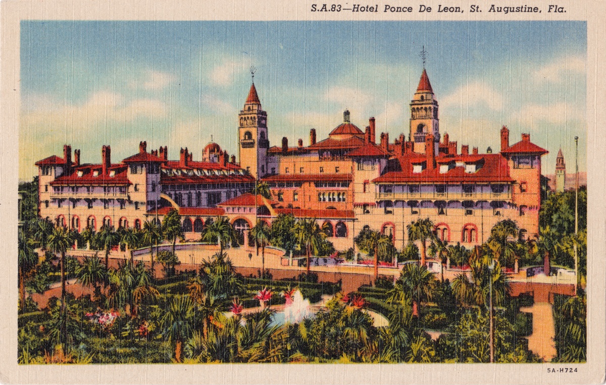
Flagler would never really forget about his time in Florida. In 1883, he married Ida Alice Shourds. By now, he was the president of the Standard Oil Company of New Jersey, and thus didn’t have the time for a summer honeymoon. But there was a place the newlyweds could go, and once again, Flagler found himself in Florida. This time, it was St. Augustine.
Flagler couldn’t get Florida out of his mind. He would pull back from his duties at Standard Oil to focus on a new obsession with tourism. Just two years later, Flagler would buy a small hotel, the Sunnyside, in St. Augustine, and build the Ponce de Leon and the Alcazar hotels to accompany it. Flagler became so deeply invested in turning the Atlantic Coast of Florida into a resort paradise that he then purchased a fourth hotel to add to his portfolio.
The Overseas Railroad

Of course, hotels are worthless if people can’t get to them, so Flagler bought a railroad. That line was the Jacksonville, St. Augustine & Halifax River Railway, which was a 36-mile narrow-gauge short line that didn’t even connect to America’s national rail network.
Flagler wasted no time in improving the railroad, converting it to a standard gauge. Then, Flagler bought the Jacksonville, Tampa, and Key West Railway. Soon enough, his railroad constructed 117 miles of trackage between New Smyrna and Lake Worth. These expansions finally properly connected the rest of America’s East Coast with Florida’s northeast and Flagler’s resorts, which he likened to being “a new American Riviera.”
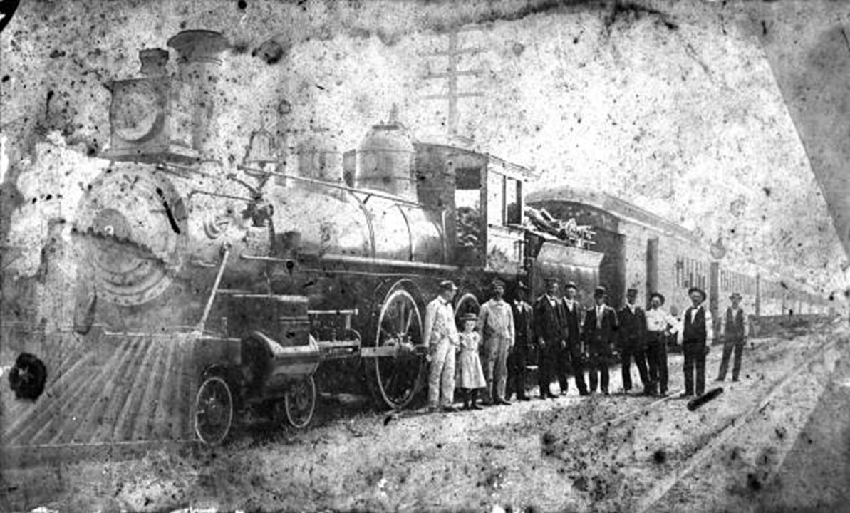
Then, Flagler’s rails went south, hitting Ormond Beach, Palm Beach, and then Miami. Wilkinson notes that Flagler didn’t just build train tracks, either. Flagler erected entire towns around his trains, building everything from schools and hospitals to fire stations and courthouses. If there was a competing railroad in his way, Flagler bought it and kept building. When Flagler reached Miami, it was still just an unincorporated settlement, but bringing trains there changed that. Flagler’s railroads would later become the Florida East Coast Railway.
It’s because of this that Flagler is sometimes called the father of Miami and the architect of much of Florida’s resort industry. It was Flagler’s obsession that led to the creation of the hotels and the expansive rail network. Flagler was never satisfied, either. In 1893, three years before Flagler’s railroad reached Miami, he was already considering expanding as far west as Tampa and as far south as Key West.
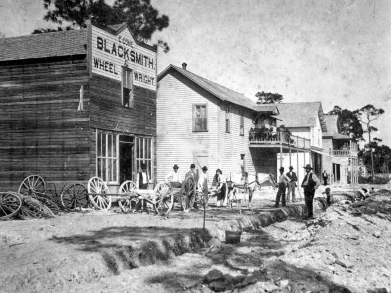
This idea caught like wildfire within Flagler as the Panama Canal started taking shape in the early 1900s. To Flagler, Key West and its naturally deep seaport were the perfect location to link the United States to trade from South and Central America, as well as Cuba.
Flagler’s idea to expand to Key West wasn’t novel. There had been practically countless suggestions for a railroad to Key West from as far back as 1831. However, every other idea faltered either because engineers believed that a railroad over the sea couldn’t be done, or that nobody could afford to build such a plan. Here’s a whole documentary about Flagler’s efforts:
That didn’t deter Flagler, who hired engineer William J. Krome to find him the best path to Key West. In 1905, Flagler was given the green light to build his railway. By now, he was 74 years old. He practically built Florida’s east coast, but he wanted even more. Keys Life Magazine describes the Herculean effort to build the Key West Extension, also known as the Overseas Railroad:
For the overseas project, Flagler purchased, leased or built most of the heavy marine equipment in the east. It was a massive operation. Land had to be donated, purchased or leased, as Flagler did not receive land grants in the Keys other than water passages. He did own land previously granted to other railroad companies that he had bought. So many of the transport ships in the Atlantic were employed solely to transport supplies and materials for Flagler that it created a minor shortage for transporting other goods. Using Krome’s survey, overland clearing throughout the Keys began. Functional seaports and rail terminals were built at Knight’s Key and Key West. The large bridges could not be started until huge floating concrete mixers could be constructed. Concrete mixer number 1 was towed out of Miami on June 27, 1906. Work began throughout the Keys. Over 130 acres of land was to be dredged/pumped in for the Key West Terminal. The work camps were numbered from north to south from Homestead. Key Largo was camp 1 and Key West was camp 82.
By the spring of 1905, construction teams were dispersed throughout the Keys. From the mainland, in April, two of the ten traveling dredges set out from what would become Florida City across Cross Key to Jewfish Creek. One dredge worked on each side of the right-of-way, piling up fill to form a track rail bed in the center. Rock was transported and spread. Tracks were laid on top of this rock foundation. The Woodall and Everglade stations were built on side tracks located where the vehicle passing lanes of the 18-mile stretch are now. This was time-consuming work, but not difficult. Jewfish Creek presented them with their first bridging challenge. It had to be a drawbridge to permit boat traffic even in those days. The crew used 150 huge barges to ferry supplies to shore.
Labor was a constant problem. The pay was $1.25 a day with food, lodging and medical care. Lack of fresh water and mosquitoes constantly haunted the project. An average of 4.5 million gallons of fresh water was required each month. It is said a total of 40,000 men, but never more than 5,000 at any one time, were employed.
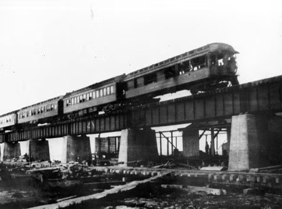
The 128-mile Overseas Railroad was built over the course of seven years, costing Flagler over $50 million ($1.7 billion in 2026), and workers had to suffer through three major hurricanes. In 1912, the Key West Extension opened. The road, which was once called “Flagler’s Folly” because few thought Flagler could do it, was considered the eighth wonder of the world.
Flagler’s expected freight traffic never really came, as Key West did not become America’s trade hub. Instead, passenger trains mostly brought people to the Keys, and the freight trains brought in food, water, and building materials to support that expansion.
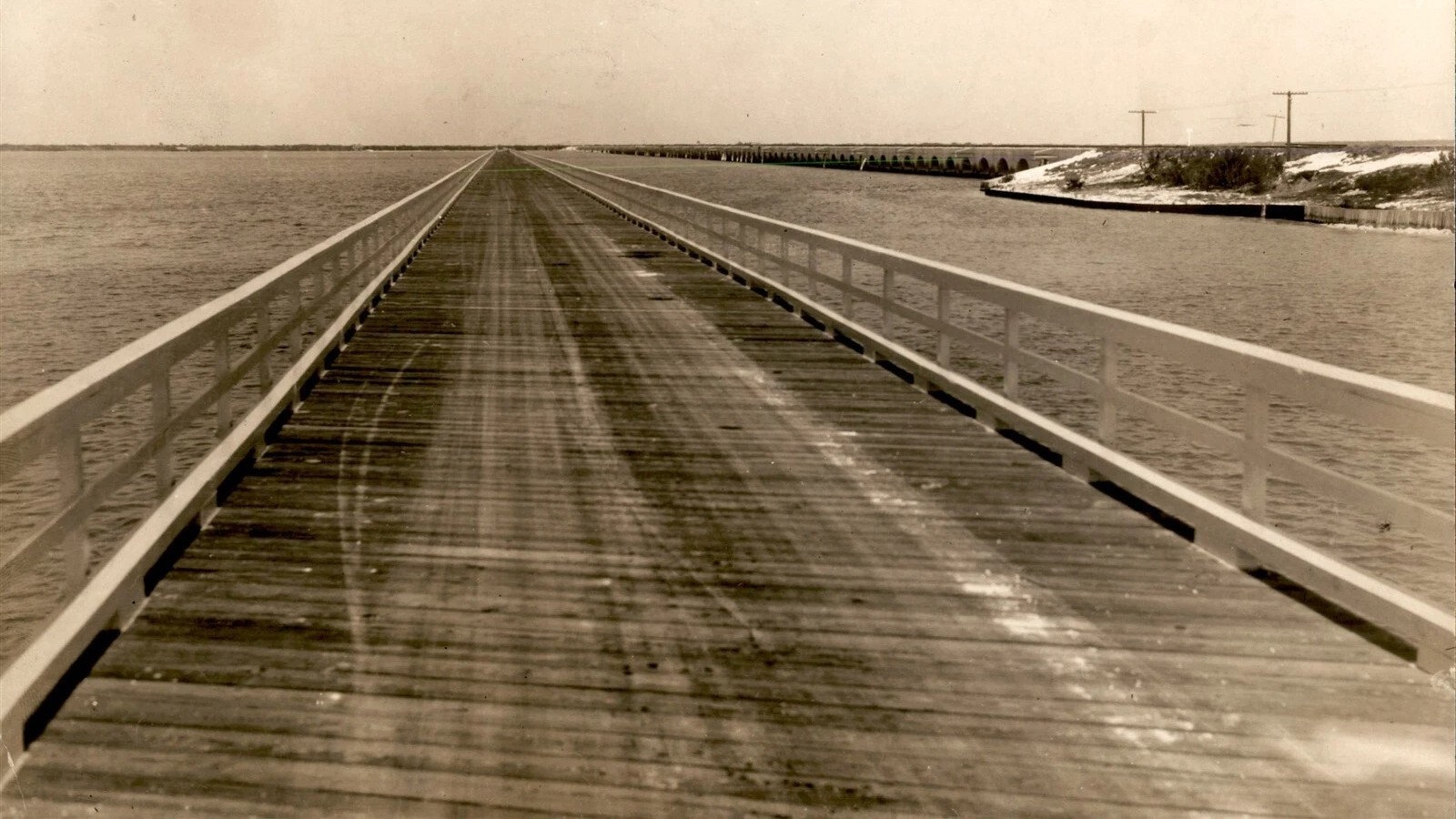
Ultimately, the Overseas Railroad was partially destroyed (below) by the Category 5 Labor Day Hurricane of 1935.
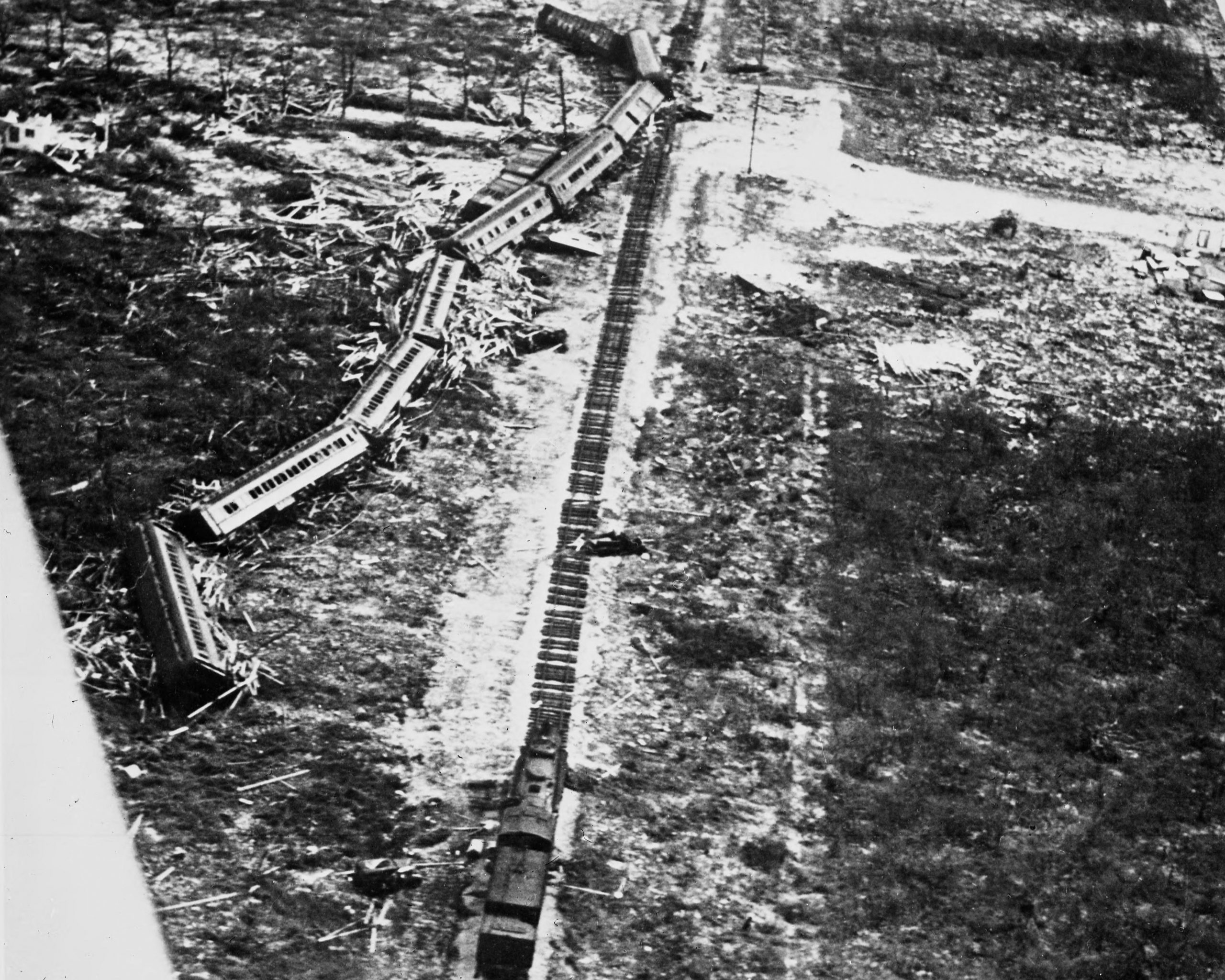
The storm claimed over 420 lives, wiped out the FEC’s Long Key Fishing Camp, destroyed the railroad’s locomotives, and destroyed 40 miles of track. The railroad had already gone bankrupt and simply couldn’t afford to fix the damage. The state of Florida and Monroe County bought the right-of-way for $640,000 ($15,671,529 today).
The First Overseas Highway

The disaster became an opportunity to expand the original Overseas Highway, which provided access to the Keys by automobile, but still wasn’t a complete highway. From Wilkinson:
A hint of a highway to the mainland was uttered in a political address by George W. Allen in 1895. To the author the first major step in modernizing land transportation in the Keys as we know it was the railroad. Along with the railroad came post offices with daily deliveries of people and goods. Many of us today think of the Overseas Highway as a direct result of the 1935 hurricane that destroyed Flagler’s Florida East Coast Railway. In many ways this is true; however, the highway actually started evolving earlier. The meager beginning takes us back to 1917, when Monroe County floated a $100,000 bond issue to build roads, or trails, on Key Largo, Big Pine Key and a bridge from Key West to Stock Island. […]
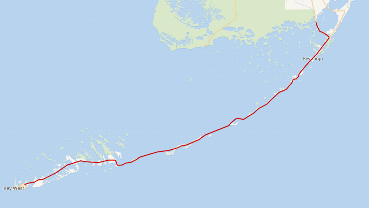
Dade County was to build 11 miles of road from Florida City to Little Card Point, a point of land between Card and Barnes Sound. Monroe County was to build a drawbridge and connect the Dade road to the existing North Key Largo road. Before it could be completed, the roadway and bridge were severely damaged by the hurricane of 1926. It was decided to raise the bridge height from five to nine feet. Tidewater Construction Company was the original bridge contractor, but S. J. Groves Co. did the final modification and repair. Awaiting for its completion, in March of 1927 a barge-type ferry towed by a powerboat transported cars from Florida City to the east end of the Card Sound bridge. This was known as the Key Largo Ferry and the point was known as Pelican Harbor. Meanwhile, Jenner Construction made the road serviceable as far as Islamorada. Another feat was using the car ferry to cross to the mainland, J. Otto Kirchheiner, chairman of the Monroe County commissioners, was the first to drive a car from Key West to the mainland on July 18, 1927.
By 1928, the rebuilt and higher off the water 2,800-foot wooden drawbridge across Card Sound was completed. The additional road and bridges were completed to Lower Matecumbe Key. The Upper Keys were connected to the Florida mainland. In the meanwhile, Key West had built a road as far as No Name Key. Construction of a ferryboat pier began at Lower Matecumbe and No Name Key.
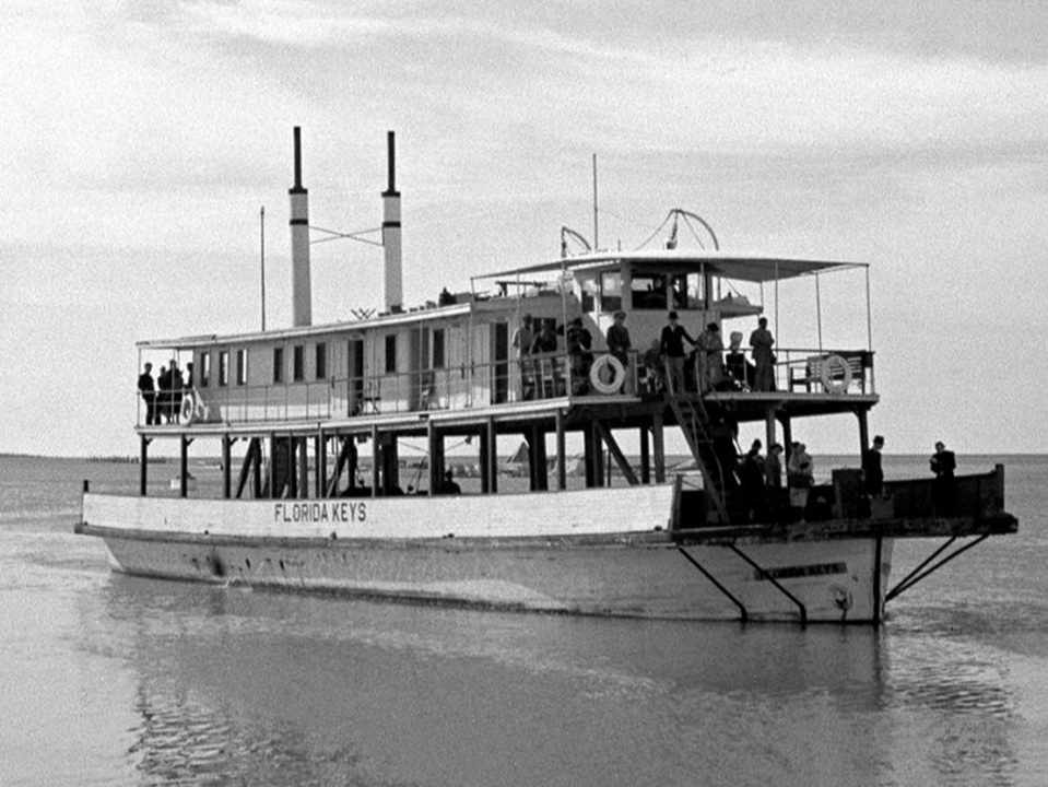
The first Overseas Highway did not reach Key West. In order to bridge the 41-mile gap between roads, three ferries were purchased for $850,000 ($16,362,254 in 2026) and used for the 41-mile journey between Lower Matecumbe Key and No Name Key. Each ferry trip was about four hours long and carried only 20 cars. Vehicles under 14 feet paid $3.50 ($67 today) while vehicles over 15 feet paid $6.50 ($125 today). Passengers had to cough up another $1 ($19.25 today) each. By 1931, the ferry route was supplanted with a 13.5-mile addition to the Overseas Highway, reaching ferry terminals on Grassy Key and Hog Key. Instead of one 41-mile trip, now the ferries handled two shorter 14-mile trips.
While it was possible to get a car from the mainland to Key West, it wasn’t a pleasurable journey. The ferries were slow, unreliable, had a limited capacity, and were expensive. They also had a problem with running aground as the water often wasn’t deep enough. It wasn’t long before plans were drawn up to replace the boats with bridges.
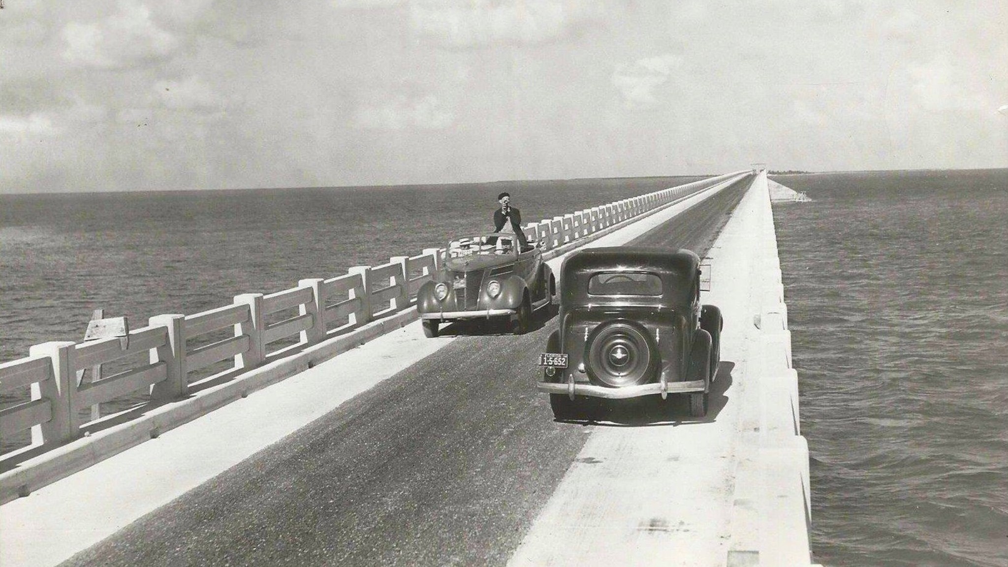
Following the 1935 hurricane, most of the old tracks were torn up, and roadbeds were put in their place. Since most of the rail bridges were still in good condition, engineers converted the rail bridges into road bridges.
This is why the Bahia Rail Bridge looks so goofy. It was really a rail bridge that engineers slapped a road on top of. To add a road to the bridge, engineers added concrete slabs to the trusses of the rail bridge, then smoothed out the climbs and descents of the trusses so cars could traverse them.
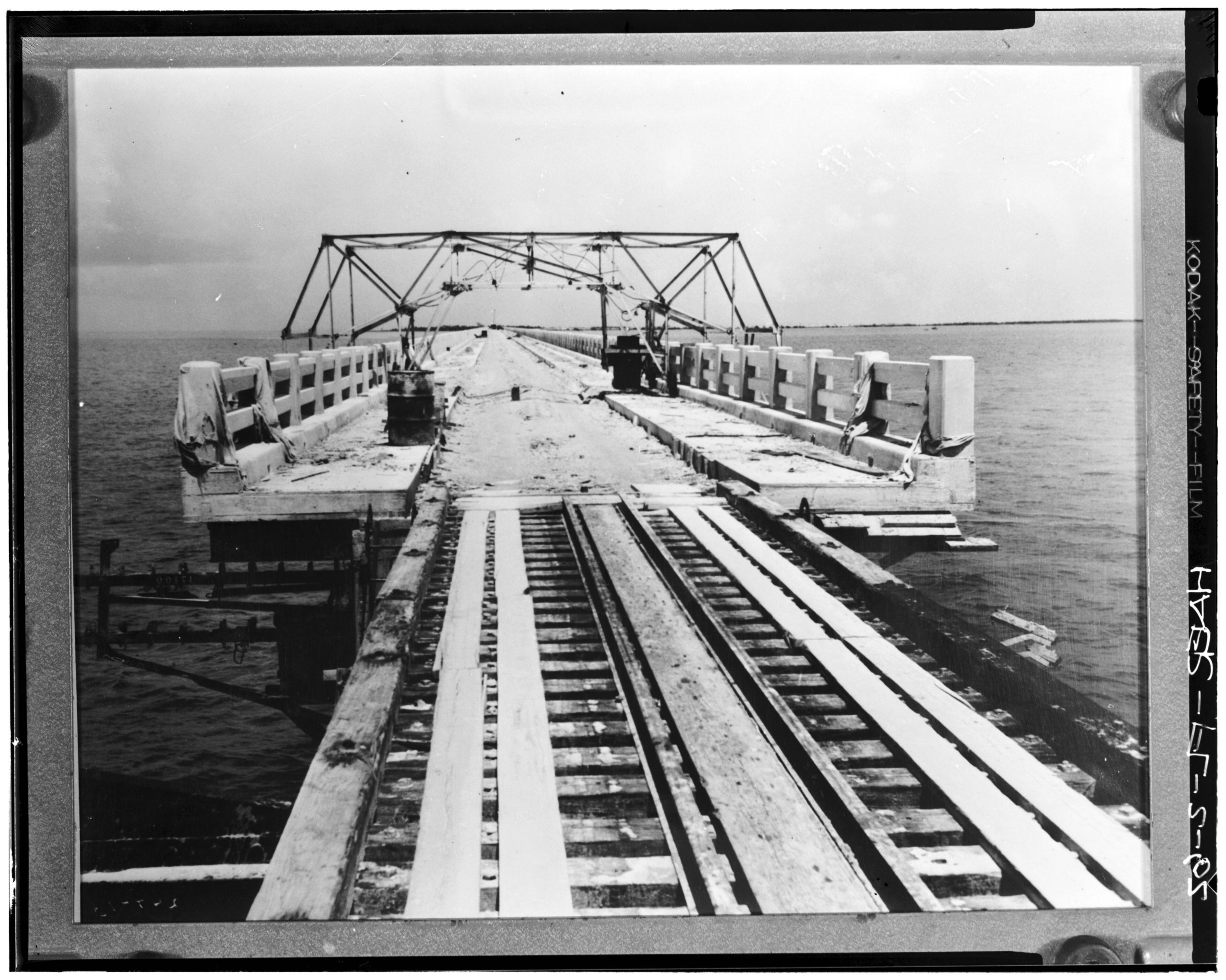
Even the famous Seven Mile Bridge started life as a rail bridge, and to save money in converting the Seven Mile Bridge for road traffic, the former tracks were mounted sideways and used as guardrails. Most rail bridges were converted by laying steel beams across the bridge, then encasing them in reinforced concrete.
Converting rail bridges to road bridges had their weird drawbacks, like narrow lanes – the roads were 20 feet wide from curb to curb – and no shoulders. But it worked, and on March 29, 1938, when the Overseas Highway opened, it finally connected Key West to the mainland by road and was considered one of the most ambitious road engineering projects in America at the time.
The Overseas Highway Got Upgraded

Much of the future of the Overseas Highway became about maintenance and improvement. During World War II, the federal government believed the highway had great military importance. Several bridges were replaced with stronger versions, and sharp curves were eliminated. Parts of the highway that did not follow the old FEC right-of-way were bypassed. This is why Card Sound Road and Route 1 both lead to the same place, but Card Sound Road takes a longer route to get there. As a result, the Overseas Highway became more than a dozen miles shorter. In 1953, the tolled portions of the Overseas Highway became free.
The next major upgrade happened in the 1970s through the 1980s. By now, the bridges – which were originally built during the early 1910s – were in a sorry state after decades of heavy traffic, hurricanes, and living in a salty ocean. Chunks of concrete began falling from the Bahia Honda Bridge while it was still in use. That bridge was the first of the remaining old bridges to be replaced when a modern bridge was built next to it, which opened in 1972. The modern version of the Seven Mile Bridge opened in 1982.

Many of the old bridges were never removed. Instead, unsafe sections were severed, and usable sections remained open to foot traffic. When you drive on the Overseas Highway today, you’ll frequently see these old bridges directly next to the newer ones.
Sadly, those old bridges continue to deteriorate, and they drop concrete into the sea. But they are majestic reminders of the past.
The Bottom Of America

While the Polaris trip officially terminated at a hotel in Key West, I couldn’t stop there. I hopped back into a Slingshot and drove one mile deeper. My destination was the Southernmost Point Buoy. It’s silly, but I’ve seen other people reach the Southernmost Point of America so many times throughout my life. For me, being the person in the photographs was a goal worth having. Maybe I thought that if I could somehow be there in Key West, it meant that I had made it in life. I’m not really sure why that buoy became such an obsession for me.
I never thought I’d make it. There was always some sort of time, financial, or work constraint that kept me away. Yet, there I was, the best version of myself, standing next to a replacement version of the iconic buoy. The only way the moment could have been better was if my wife could have been there.
None of it would have been possible had it not been for the obsession of Henry Flagler and the genius engineers who converted a railway into a highway. It’s frankly amazing that it’s possible to drive over 100 miles over an ocean like it’s nothing, and it’s another example of the marvels that people can create. I think the Overseas Highway is a part of the American road trip experience that I think everyone should try at least once. I loved it so much that I can’t wait to do it again, but in my own vehicle.
Top graphic images: Tinsley Advertising; Mercedes Streeter


I was confused by the picture of the Southernmost buoy, as there wasn’t a pier next to it when my wife and I visited last year. I see that it has been temporarily moved due to construction.
This is a timely piece, as my wife and I will be making the Miami to Key West vacation drive at the end of this month! Thanks for the history lesson!
Fascinating article, Mercedes! I have seen Flagler’s name many times around Florida but never researched into why that was.
Our best friends flew with us from Houston into Miami four and a half years ago and then drove a rented Chrysler Pacifica down to Key West. Higher up, we could probably see a bit more of the landscape than you did in those Slingshots. I love that drone shot of you guys heading south on Card Sound Road. The Pacifica was a great car for transporting two couples and a week’s luggage to a great vacation spot.
While in Key West we rented little 50cc Buddy scooters and Kawasaki Jet Skis. What was weirdly interesting to me is how the scooter’s CVT felt not unlike taking off on the Jet Ski. The engine winds up and you just start moving quicker and quicker.
I am glad you got to pose with the buoy. It was so crowded when we were there in mid-October that we didn’t want to wait for the dozens of people to get their shot. We saw it. That was good enough for us.
I have been on Nevada State Highway 50 as far east as Fallon (now home of the Navy’s Top Gun school) and all the other roads you mentioned. I-10 east into Louisiana also seems like quite an engineering and construction feat. (But it sucks when there’s a wreck and no alternate route for miles.) The vision, challenges and money spent building them and the entire Interstate program back then is a gift to us all today. And we should be paying what it takes to maintain them lest they suffer the same ongoing fate of the original Overseas Highway.
In tribute to Flagler and his contributions to Florida his name is found throughout the state. From beaches, to colleges to counties and more.
Also Watch True Lies. The bridge destruction scene was real as that part was due for demolition anyway.
Are these islands part of the continent?
We took a spring break trip to Duck Key, near Marathon. We bowled a few times there, as it was hot even in March, and I got burnt the first day and wasn’t going to be out in the sun.
On our way back to Miami, we convinced my dad to drive to Key West instead. We had to leave an hour earlier than planned, but that’s OK.
I’ve driven the route once, in a Mini Countryman, just right before Covid hit.
It is as lovely as you described.
If California can’t even build a new train nowadays it’s amazing they managed to build a bridge over dozens of miles of ocean.
I’ve driven it many times, and the further south the more wonderful it gets.
Drove the length of hwy 1, then 101, from south LA all the way to WA and took a ferry to Victoria. Beautiful but exhausting. Driven A1A from Jacksonville to Key West a few times. Amazing road but another incredibly exhausting trip. And that Lake Pontchartrain bridge takes forever!
One I would recommend is hwy 87 from Raton, NM toward Amarillo. But do it at night. Not all of it is good, but it’s long, mostly straight, and there will be little to no one on the road. So pop on the high beams and fog lights, and just fly.
We got to make this drive some years back and there was a wreck in the middle of the 7 mile bridge that brought traffic to a stop for almost an hour. As we were getting out of our car with TEXAS plates the guy behind me started shouting “DALLAS SUCKS!!!” And since I’m from Houston I shouted back “I AGREE!!!” Turns out the Dallas basketball team had done something to the Miami basketball team during some sort of sportsball contest the night before.
Anyways, that was a pretty cool hour we spent on that bridge getting to know everybody and watching the fisherman and sharks passing through the water under the bridge followed by a fun week in Key West where we enjoyed conch fritters, liimeade, Hemingway’s cats, drag shows, a really sketchy rental scooter, and a scorpion in our hotel room. Good times.
I went to Key West every spring for 15 years, sometimes driving from Fort Lauderdale or Miami, sometimes flying, 1988 to 2003. Eventually it wasn’t the same and the episode ended, but oh how I loved it.
Really interesting! All I knew was that it had originally been a railroad, but not that the project was privately funded and executed or all the other history to it.
Have you driven from the DelMarVa peninsula to mainland Virginia? Going under the ocean is beyond freaky
History seems poised to repeat itself, as Brightline is an outgrowth of Flagler’s old railroad company and now seems to be teetering on the edge of bankruptcy as we speak (Brightline being a part of Florida East Coast Industries and still running on some Florida East Coast Railway tracks)
If you like bridges (and long scenic drives) I recommend the Great River Road down the Mississippi. You can ping pong back and forth from one side of the river to the other, bridges and the occasional ferry every few miles.
https://experiencemississippiriver.com/the-great-river-road-the-best-drive-in-america/
As a structural engineer, it feels so weird reading about record-setting bridges without the word “China” plastered front and center.
…and I would walk 56.5 miles and I would walk 56.5 miles more…
…just the be the man that walked 113 miles of converted rail bridges to fall down at the Southernmost Point Buoy.
…
…
DA DA DA!
DA DA DA!
Da da da da da da dadadada!
Now you’ll have to take a road trip to the Northwest Angle, MN to get a pic with the northernmost point buoy.
If you press down on both of them at the same time, the country will reboot.
DO IT! DO IT NOW!
Great now we ended up with Robo-Nixon as emperor.
0.0001% corruption! Still a jerk.